Mount Batur
English
IDR
Language
Currency
Contents

A guide to Mount Batur's geography so you know what to expect!

Learn about the geography of Mount Batur, an active volcano in the heart of Bali

Towering over the landscape of Bali, Mount Batur is an active volcano! Formed by a series of dramatic collapses, it boasts a vast caldera and a sunken crater that holds a serene caldera lake. Volcanic features like lava flows and cinder cones paint the landscape, but Mount Batur is more than just a volcano! Its slopes are home to a unique ecosystem, where hardy plants and resilient animals thrive in the shadow of the volcano.

Here are things you need to know about the geography of Mount Batur, especially if you’re planning to go on a Mount Batur tour!

Mount Batur’s geography at a glance

Mount Batur’s geography
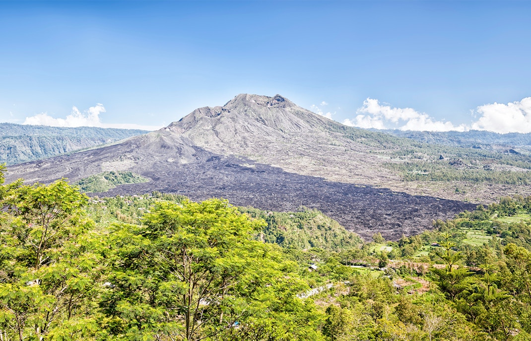
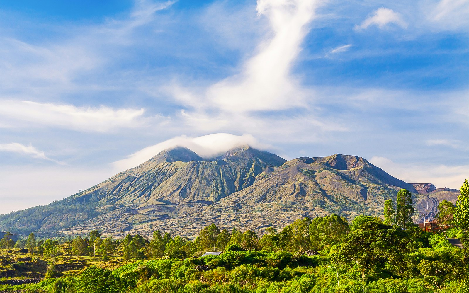
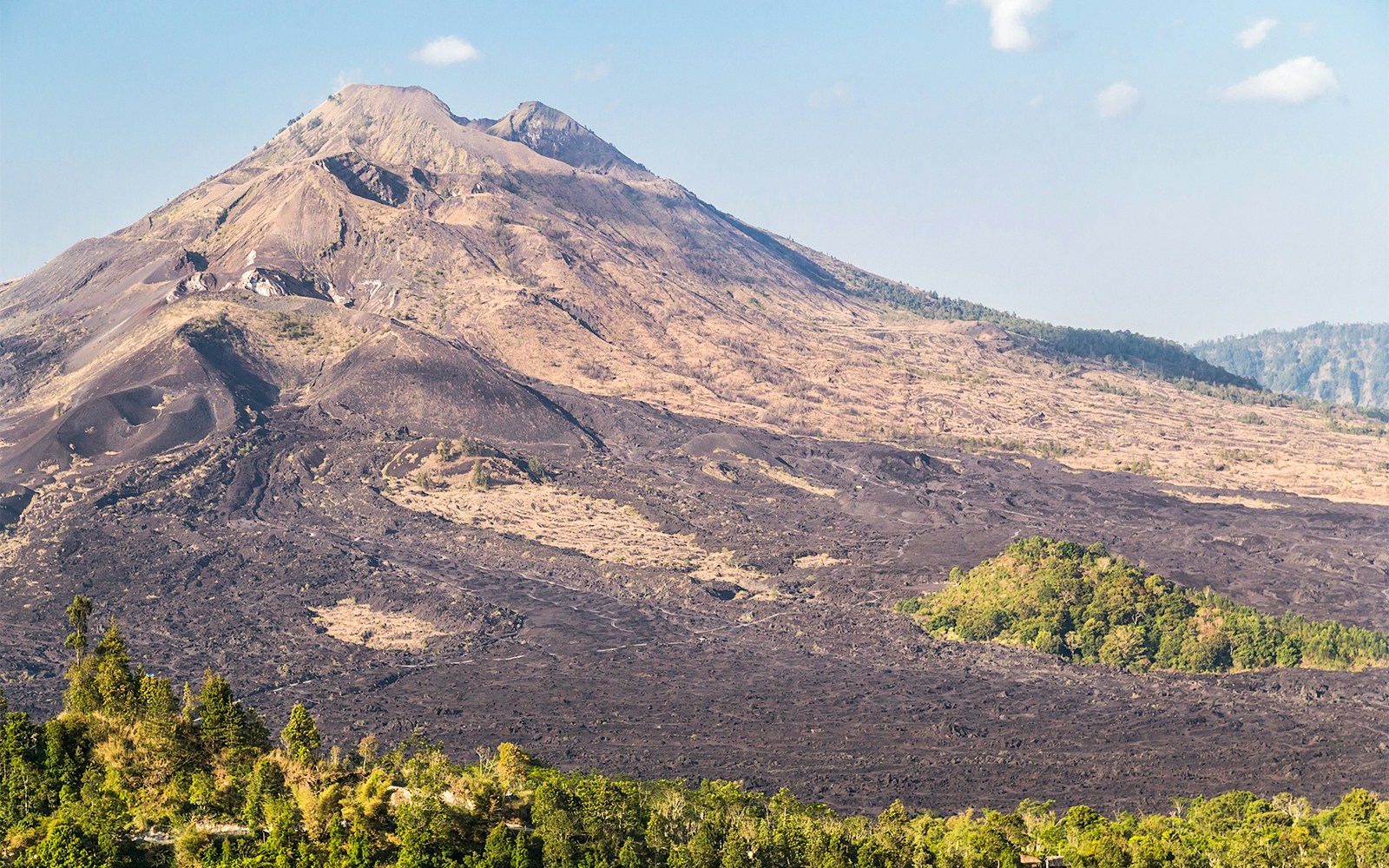
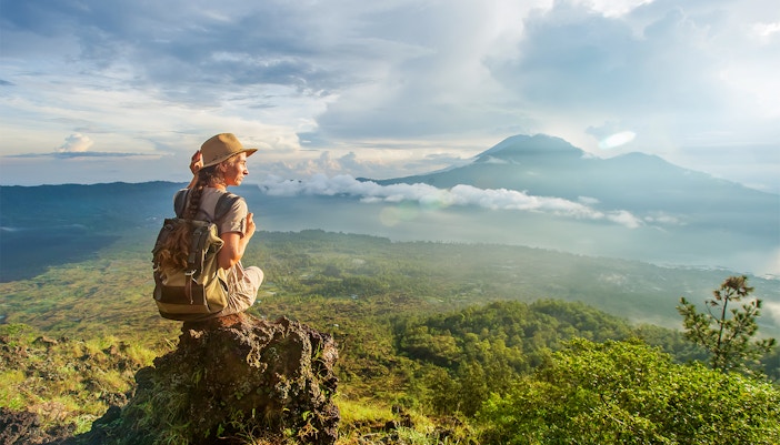
  • Elevation: 1,717 meters (5,633 feet) above sea level
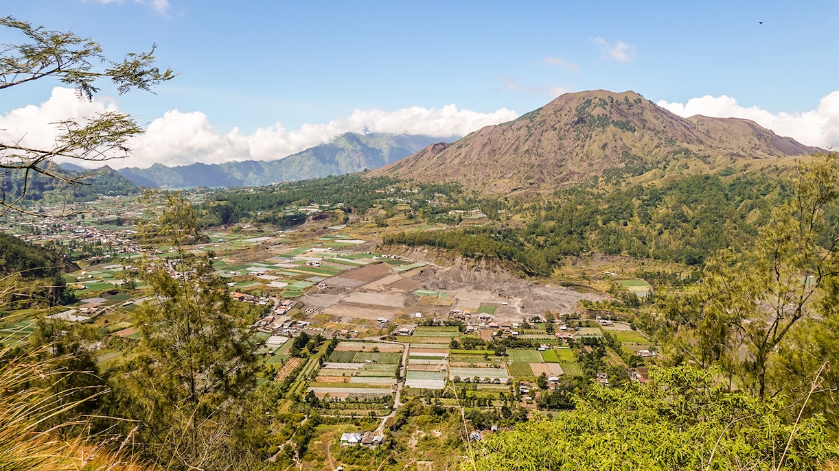
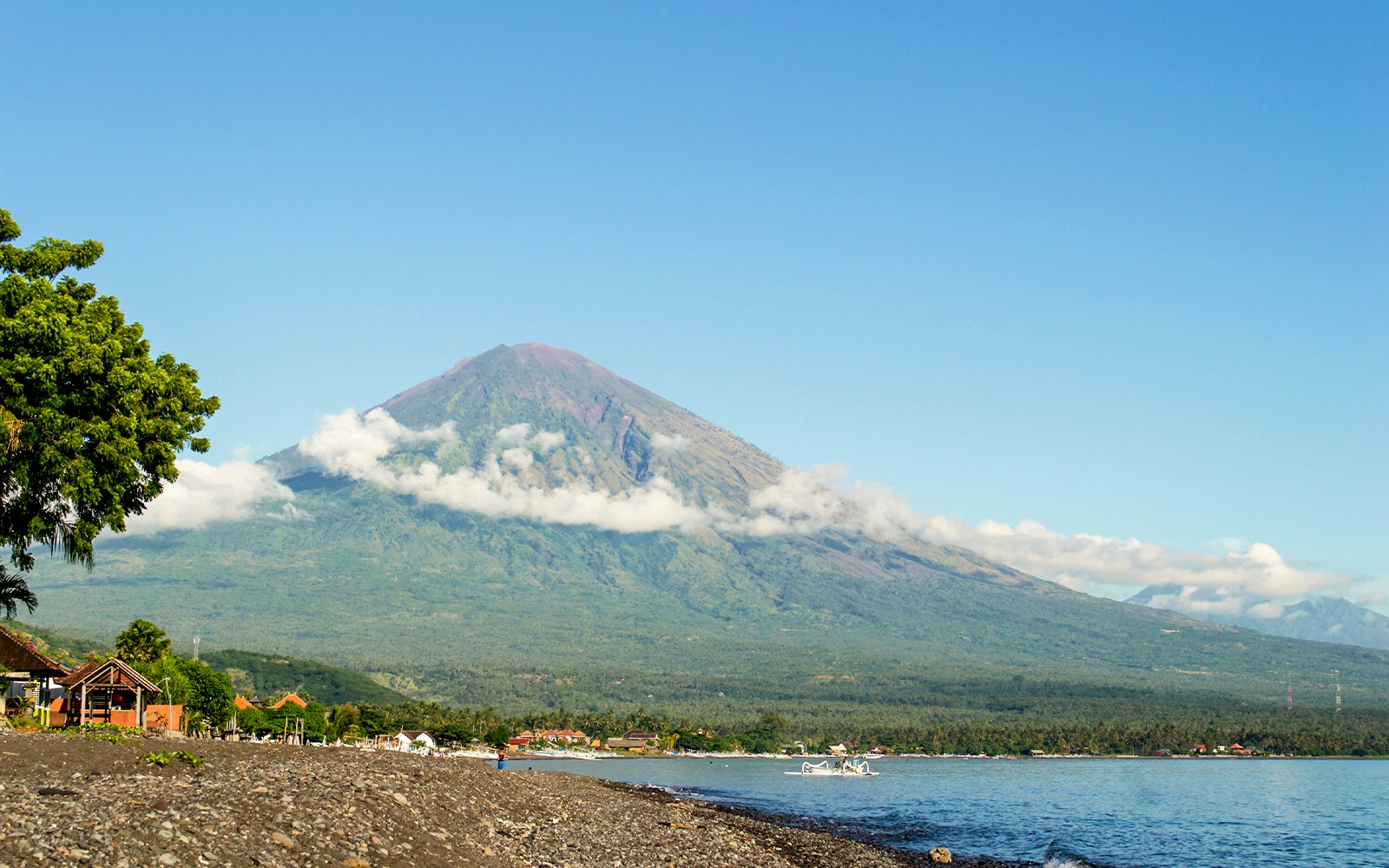
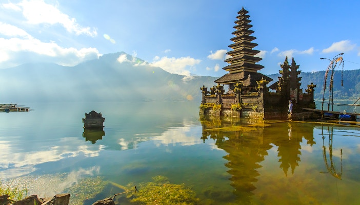
  • Location: Bangli Regency, Bali, Indonesia (part of a volcanic complex northwest of Mount Agung)
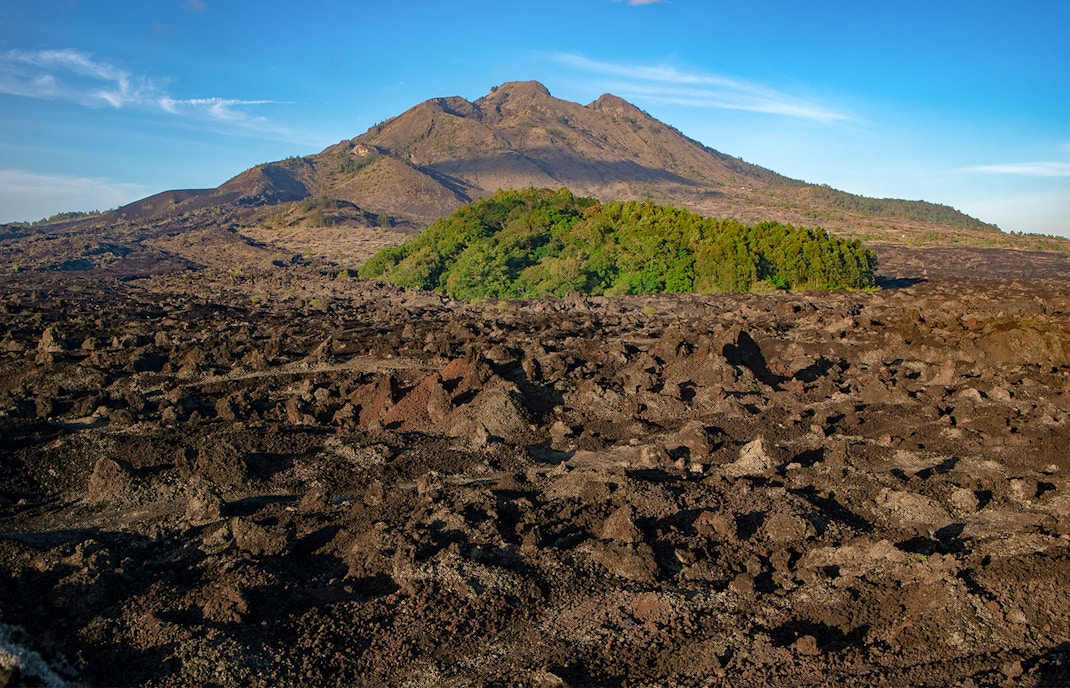
  • Last eruption: 1999 to 2000 (considered an active volcano)
  • First ascent: Historical records are unclear, but likely by indigenous people long ago
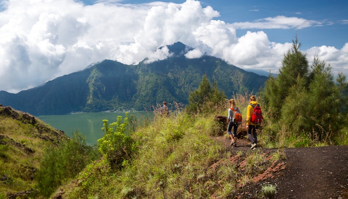
  • Hike difficulty: Easy to moderate (depending on fitness level)
  • Type of volcano: Stratovolcano (layered cone volcano)
  • Number of trails: Several trails lead to the summit, with varying difficulty levels.
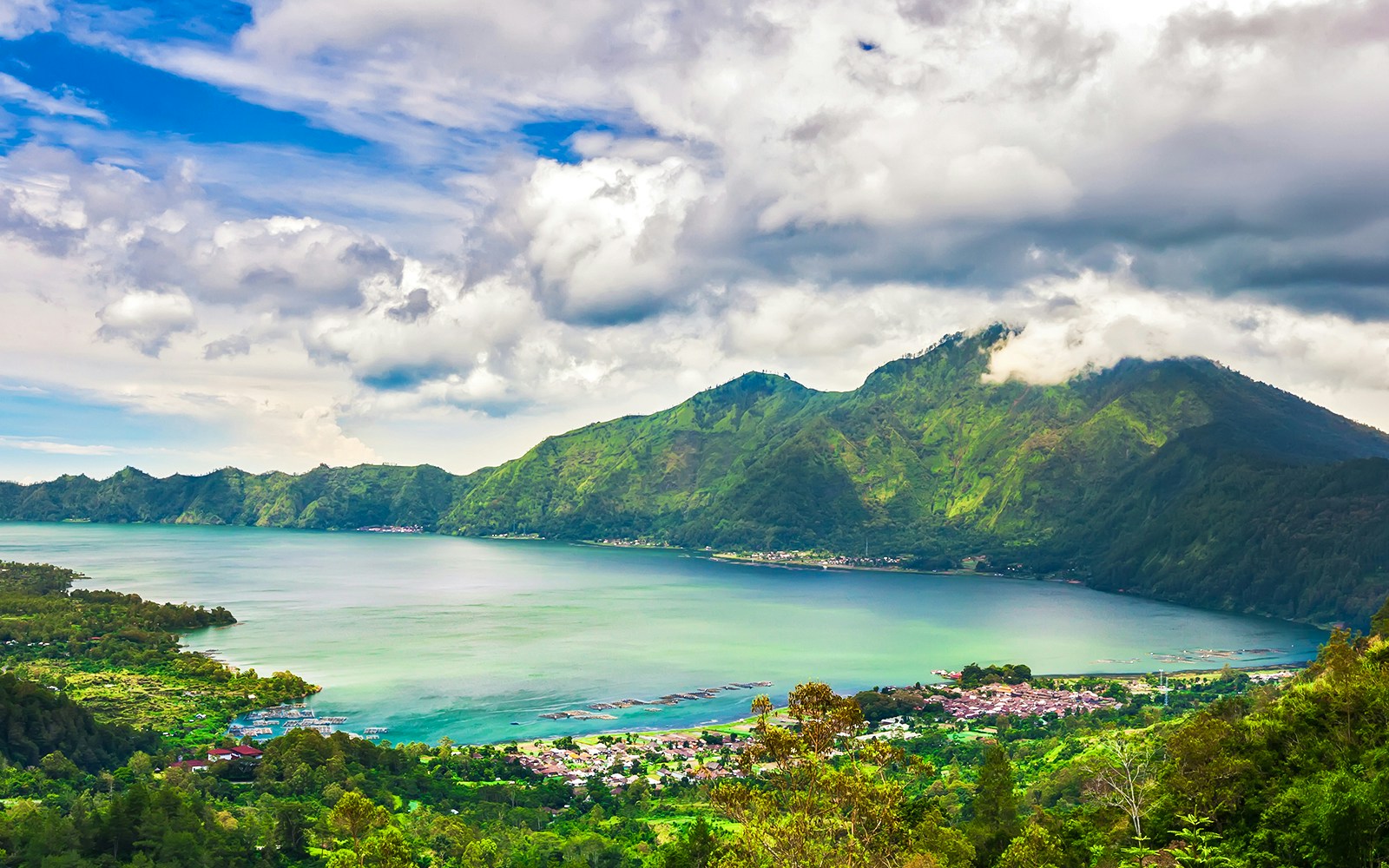
  • Crater diameter: Approximately 10 kilometers (6.2 miles)
  • Base diameter: Approximately 13 kilometers (8.1 miles)
  • Number of crater peaks: 1 (Mount Batur itself forms the central peak within the caldera)

The geographical history of Mount Batur

Mount Batur’s geography

Formation

  • Mount Batur's story began around 29,300 years ago with a massive eruption, forming the outer caldera (10 km diameter).
  • A second eruption 10,000 years later carved a smaller caldera (6.4 km) within, creating a nested structure.
  • Mount Batur itself is a stratovolcano built from layers of lava, ash, and rock from these eruptions.
  • Volcanic activity continued with lava flows and cinder cones shaping the landscape.
  • The most recent eruption occurred in 1999-2000, solidifying its status as an active volcano.
  • Today, a serene caldera lake fills part of the inner crater, a result of rainwater and volcanic activity.
Mount Batur’s geography

Mount Batur today

  • Mount Batur occupies a central position today within the Bangli Regency in Bali, Indonesia.
  • It's not a solitary giant, but part of a larger volcanic complex northwest of the even more famous volcano, Mount Agung.
  • While Bangli Regency is its immediate home, Mount Batur's presence can be felt in neighboring prefectures like Kintamani, known for its fertile volcanic soil and stunning views of the caldera lake.
  • Towering over the surrounding area, Mount Batur can be seen from various parts of Bali, particularly the southern tourist hubs like Seminyak and Ubud, acting as a constant reminder of the island's volcanic history.

The climate of Mount Batur

The climate here is a fascinating interplay between Mount Batur’s geography and its location within the tropics. 

  • Elevation matters: Mount Batur's height of 1,717 meters (5,633 feet) plays a significant role in its climate. As you climb higher, the temperature drops. Expect a cool and refreshing escape compared to the balmy coastal regions of Bali.
  • Volcanic influences: The caldera acts like a giant bowl, trapping cooler air at night and creating a microclimate with a wider temperature range. During the day, the caldera floor can heat up quickly due to the reduced air circulation.
  • Seasonal swings: Bali experiences a tropical monsoon climate with a wet and dry season. Mount Batur experiences these seasons as well, with the wet season (December to March) bringing increased rainfall and sometimes cloud cover, particularly in the early mornings. The dry season (April to November) offers clearer skies, but can be slightly cooler at night due to less cloud insulation.
  • The Wind Factor: The caldera's rim can be quite windy, especially in the early mornings and evenings. Be prepared for brisk winds as you stand at the summit, particularly during sunrise hikes.

The best ways to explore the geography of Mount Batur

Mount Batur’s geography

Mount Batur trails and routes

Mount Batur’s geography

Toya Bungkah Starting Point 

Difficulty: Moderately difficult
Duration: 2 hours

The most popular starting point, this route involves a steep ascent for a few hours. This well-maintained trail is shorter and easier compared to the other routes you might take, but it's also the most crowded.

Mount Batur’s geography

Pura Jati 

Difficulty: Challenging
Duration: 3 hours

This is a trek that’ll start from the Pura Jati temple. This is a great starting point for if you want to views of the Mount Batur lake as you’re going up!

Mount Batur’s geography

Serongga Village

Difficulty: Challenging
Duration: 4 hours

Serongga Village is one of the many that dot Mount Batur. This one will be a challenging trek, and you will experience a whole other side of Mount Batur (literally!); the steeper and rockier side.


Book your Mount Batur tours!

Mount Batur Sunrise Trek with Breakfast & Hotel Transfers
Instant Confirmation
Mobile Ticket
8 hr. - 10 hr.
Guided Tour
Transfers Included
More details
from
Rp675,000
Mount Batur Sunrise Trek & Visit to Natural Hot Springs with Private Round-Trip Transfers
Instant Confirmation
Mobile Ticket
10 hr.
Guided Tour
Transfers Included
More details
from
Rp700,000
Mount Batur Sunrise Trek and Hidden Waterfalls Tour with Round-Trip Transfers
Free Cancellation
Mobile Ticket
10 hr.
Guided Tour
Transfers Included
More details
from
Rp750,000
Mount Batur Private Sunrise 4X4 Jeep Tour
Instant Confirmation
Mobile Ticket
Flexible Duration
Guided Tour
Transfers Included
More details
from
Rp700,000
Mount Batur & Natural Hot Springs Private Sunrise Jeep Tour
Free Cancellation
Mobile Ticket
9 hr. 30 min.
Guided Tour
Transfers Included
More details
from
Rp840,000

Mount Batur geography: FAQs

What is a caldera, and how did it form?

A caldera is a massive depression formed by the collapse of a magma chamber roof. When a volcano erupts and expels a large amount of magma, the ground above the chamber can no longer support its own weight and caves in. This creates a large, often circular depression that can be several kilometers wide.

How big is Mount Batur's caldera?

Mount Batur's caldera is a staggering 10 kilometers (6.2 miles) in diameter and roughly 700 meters (2,300 feet) deep. Imagine a giant crater big enough to swallow a small city!

What is Lake Batur, and how did it form?

Nestled within the caldera is the beautiful Lake Batur, a crescent-shaped lake with a surface area of approximately 16 square kilometers (6.2 square miles). The lake's formation is a combination of factors. Rainwater collects in the depression, and volcanic activity can contribute to the water level through hydrothermal vents and steam condensation.

Is Mount Batur an active volcano?

Yes, Mount Batur is considered an active volcano. Its most recent eruption occurred in 1999-2000, spewing lava and ash. While not constantly erupting, it's a reminder of the island's volcanic origins.

What kind of volcano is Mount Batur?

Mount Batur is a stratovolcano, also known as a composite volcano. These conical mountains are built layer by layer from lava flows, ash, and volcanic debris ejected during numerous eruptions.

Is it safe to go up Mount Batur when it’s an active volcano?

Yes! It’s active, but it’s not spewing ash or lava, so it’s perfectly safe. You can always check before you leave, as authorities strictly monitor the activity of this volcano

What is the geology of Mount Batur?

Mount Batur comprises two volcanic calderas, a volcanic landscape complete with caldera walls, cones and craters, geothermal phenomena such as fumaroles and hot springs, a lake, lava flows, pyroclastic flows and tephra. At the top, you can see steam rising from the ground!

Is there lava on Mount Batur?

Not red hot lava, but you can see dried up (and cooled) dark lava on the sides of the slopes and molten lava rocks dot the pathways in villages.

Does Mount Batur erupt?

Not since the year 2000. And it doesn’t look like it might erupt any time soon. You can always check beforehand.

Does Mount Batur get cold?

It’s usually chilly year round until the sunrise, but particularly in the winter months between December and March. Temperatures drop down to about 14 degree celsius.

Is Mount Batur muddy?

It’ll likely be quite dusty if you’re visiting in the dry seasons. Would highly recommend carrying a mask in case of allergies! If you’re visiting after it rains, you’ll find that the paths are muddier.